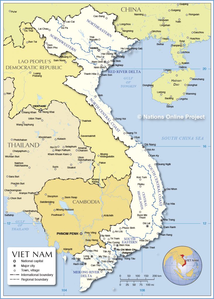
The map shows Vietnam, officially the Socialist Republic of Vietnam, a country in Mainland Southeast Asia. The nation is situated on the eastern part of the Indochinese Peninsula with a coastline along the South China Sea. It borders China in the north, it has a long border with Laos, and it borders Cambodia in the southwest. Vietnam shares maritime borders with Indonesia, Malaysia, the Philippines, and Thailand.
The long stretched country covers an area of 331,689 km², compared it is about half the size of France, or slightly larger than the U.S. state of New Mexico.
Vietnam has a population of 94 million people (est. 2018), the national capital is Hanoi, the largest city is Ho Chi Minh City (Saigon). Spoken language is Vietnamese.
Political Map of Vietnam
The map shows Vietnam and surrounding countries with international borders, the national capital Hanoi, major cities, main roads, railroads, and major airports.
You are free to use above map for educational purposes, please refer to the Nations Online Project.
This is a polish visa page
support@wietnamwizy.com
24/7 days online Support
Satisfaction Guaranteed
100% Money back guarantee
Necessary cookies are absolutely essential for the website to function properly. This category only includes cookies that ensures basic functionalities and security features of the website. These cookies do not store any personal information.
Any cookies that may not be particularly necessary for the website to function and is used specifically to collect user personal data via analytics, ads, other embedded contents are termed as non-necessary cookies. It is mandatory to procure user consent prior to running these cookies on your website.